 Project Description:
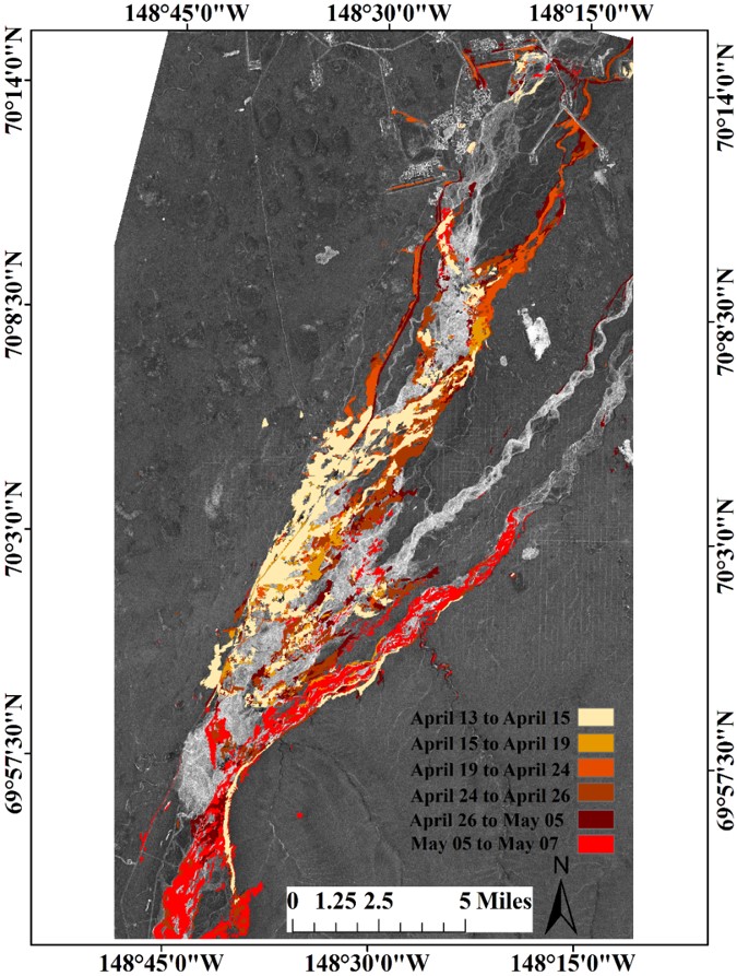
Since the launch of Sentinel-1 (S-1), SAR has become a valuable tool in the monitoring of hazard events such as the tracking of floods. This project will look at the performance of Sentinel-1 for monitoring aufeis flooding events on Alaska’s North Slope, specifically aufeis hazards along the Sagavanirktok River, AK. Amplitude change detection techniques will be used and applied to S-1 data covering the 2015 Sag River flood event. A comparison to flood maps produced from high-resolution TerraSAR-X SAR data (see Figure) will be done to evaluate flood mapping performance. The study may be expanded to the current break-up season in Alaska.
Student Leading the Project:
Richard Buzard, University of Alaska Fairbanks