Project Description:
The goal of this project is to evaluate techniques for the improvement of DEMs available for planetary bodies such as Venus. Studying volcanic systems on Venus is of great interest to the research community, however, limited DEM resolution on Venus is limiting these studies to larger volcanic edifice. This study is using terrestrial analyogs (both volcanic and sensor analogs) to evaluate techniques for DEM improvement using SAR.
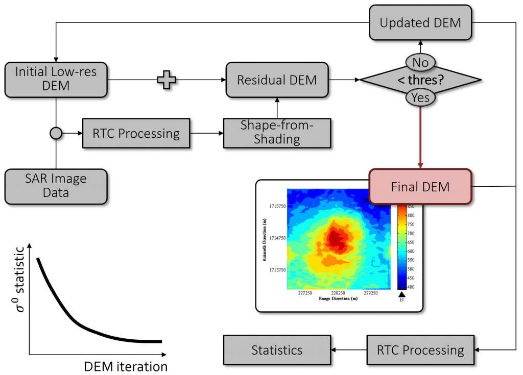
This project will be led by two students: The first part of the project will evaulate Shape from Shading (SfS) techniques to estimate residual topography once an initial (low-resolution) DEM was removed from the data using Radiometric Terrain Correction (RTC) processing. An iterative approach is envisioned where DEMs are updated in iterations until residual DEM estimates are below a threshold. The second part of the project has to do with DEM quality evaluation. Following the hypothesis that after RTC processing radar brightness variations across a volcanic edifice should diminish as DEM quality improves, statistical parameters about radar cross section variation will be derived to evaluate DEM quality.
Students Leading the Project:
Joshua Knicely, University of Alaska Fairbanks [Shape from Shading for DEM improvement]
Lindsey Dorn, University of Alaska Fairbanks [DEM quality analysis using RTC processing]