Hazard Monitoring from InSAR & RTC Data

Project Description:

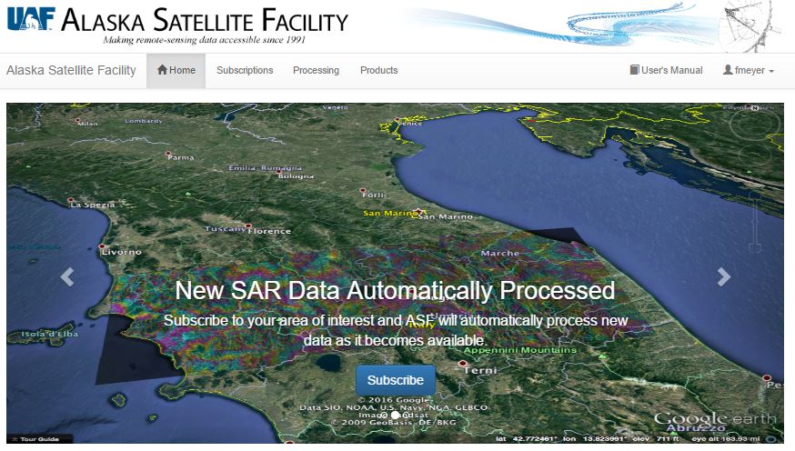
This project will work in collaboration with the Alaska Satellite Facility (ASF) to integrate the hazard monitoring-relevant SAR techniques InSAR and RTC processing into ASF’s cloud-based processing engine Hyp3. Once integrated, this hazard monitoring work flow can be invoked (either manually or using an automatic trigger) to produce deformation maps and change detection maps for a range of natural hazard events. It is the goal of the project to then share generated hazard product with the public via a standalone web interface.

The project goals include: (1) Integrate  already available automatic processing flows for InSAR processing and Radiometric Terrain Correction (RTC) within Hyp3; (2) connect these workflows with external hazard triggers such as the USGS earthquake notification service; (3) store produced InSAR and RTC products in a local archive; and (4) share these products with the world via a web-interface.

Student Leading the Project:

Matthew Whitley, University of Alaska Fairbanks

InSAR Time-Series Analysis of Kamchatka Volcanoes

Project Description:

This project analyzes InSAR time-series data at Bezymianny and Tolbachik volcanoes, Kamchatka, to determine if there may be any detectable link in deformation signal between the two volcanoes. Nearby Klyuchevskoy volcano is very active and therefore it may be difficult to isolate any signal of Bezymianny from other volcanoes in the Klyuchevskoy Group. In previous work, Tolbachik and Bezymianny were shown to likely have some sort of connectivity at depth based on isotopic signatures. The geometry and specific depth of any dike-like features is still inconclusive but may range between 15-30 km. The student proposes building upon previous work at Tolbachik and the Klyuchevskoy Group by using Sentinel-1, Sentinel-2, and ALOS data.

Student Leading the Project:

Jill Shipman, University of Alaska Fairbanks

Assessing Burn-Related Permafrost Change Using InSAR

Project Description:

It has been shown in recent work that wild fire events in Arctic environments can lead to a drastic changes in the active layer and the underlying permafrost regime [e.g., Iwahana et al., 2016].  These changes can lead to significant surface deformation that may threaten local infrastructure. This study will use Sentinel-1 InSAR data to study how recent wild fires in Alaska affected permafrost change-related surface deformation. Most emphasis is put on recent burns in the Fairbanks North Star Borough area.

Student Leading the Project:

Cole Payne, University of Alaska Fairbanks

Long-Term Hydrological Changes at the Sag River, AK

Project Description:

Gravel extraction along the Sagavanirktok River, Alaska during the construction of the Dalton Highway and Trans-Alaska Pipeline has led to changes of the river’s hydrology and dynamics. The objective of this project is to analyze changes in the river’s width, roughness and seasonal hydrology related to the  construction of the named pipeline and highway. To do this analysis, the project will utilize  the 39-year SAR archive of the Alaska Satellite Facility. The work flow of this project includes the identification of images (starting with Seasat (1978)), the geocoding of all images to a common projection and the analysis of images for temporal trends.

Student Leading the Project:

Sai Ravi Chand Paturi, University of Alaska Fairbanks

Melt Season Length at Larsen-C from SSM/I

Project Description:

This class project will be to use passive microwave data to quantify melt season length along the Antarctic Peninsula. The goal is to assess changes in season duration throughout the last 20 years. The  project will especially focus on the Larsen C ice shelf, although the developed  method could also be applied to the rest of the antarctic coasts and ice shelves.

This project will be based on Special Sensor Microwave/Imager (SSM/I) data. The dataset is available through the services of the National Snow and Ice Data Center (NSIDC) and can be downloaded from here. This dataset provides daily polar coverage since 1987 with 25km resolution on 19H, 19V, 22V, 37H, and 37V frequencies. While there is also higher resolution data available from this sensor (85 GHz or 91 GHz in H & V polarization  with 12.5km resolution), those frequencies will only tell us about melting that is much closer to the surface.

Student Leading the Project:

Andrew Johnson, University of Alaska Fairbanks

Fire History and Regrowth from PolSAR and InSAR Data

Project Description:

This project will be looking a fire scars in the Fairbanks, Alaska area and will evaluate the benefit of PolSAR and InSAR data for evaluating vegetation type and vegetation regrowth for these scars. Validation information for SAR-derived data may be available through the LANDFIRE and Monitoring Trends in Burn Severity (MTBS) programs of USGS. SAR data will include ALOS PALSAR and Sentinel-1.

Student Leading the Project:

Hannah Huhman, University of Alaska Fairbanks

Glacier Motion From SAR

Project Description:

This project will use time series of Sentinel-1 SAR images over  Steele and Walsh glaciers, Yukon Canada, to estimate their ice velocity with their variation in time. Ice motion tracking is done using Speckle tracking procedures embedded in the GAMMA Remote Sensing Software Tools.

Student Leading the Project:

Kenneth Arnoult, University of Alaska Fairbanks